 | Could satellite mapping technology help douse wildfires quickly? |
With wildfires becoming bigger and more destructive, agencies and officials tasked with preventing and battling the blazes could soon have a new tool to add to their arsenal of prescribed burns, pick axes, chain saws and aircraft.
The high-tech help could from areas not normally associated with fighting wildfires: artificial intelligence and space.
Lockheed Martin Space, a division of Lockheed Martin headquartered in Denver, is tapping decades of experience in managing satellites, exploring space and providing information for the U.S. military. They want to use that expertise to offer more accurate data quicker to ground crews fighting wildfires and are talking to the U.S. Forest Service, university researchers and a Colorado state agency about how their technology could help.
By generating more timely information about on-the-ground conditions and running computer programs to process massive amounts of data, Lockheed Martin representatives say they can map fire perimeters in minutes rather than the hours it can take now.
They say the artificial intelligence, or AI, and machine learning the company has applied to military use can enhance predictions about a fire's direction and speed.
The work of firefighters "is very similar to that of the organizations and folks who defend our homeland and allies. It's a dynamic environment across multiple activities and responsibilities," said Dan Lordan, senior manager for AI integration at Lockheed Martin's Artificial Intelligence Center. The company's technology could reduce the time it takes to gather and share information about wildfires.
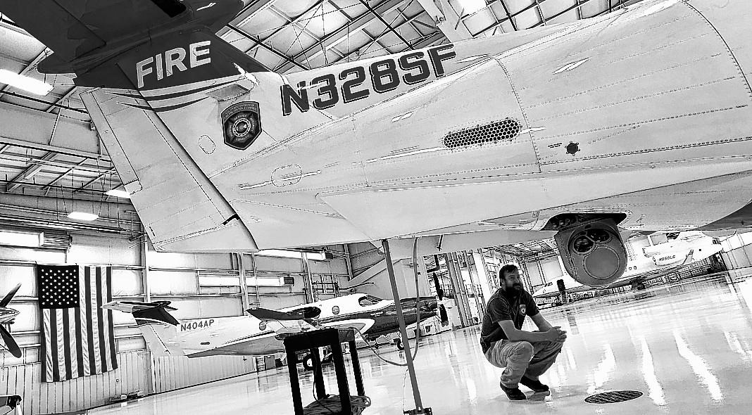
Since 2014, the Colorado Division of Fire Prevention and Control has flown planes equipped with infrared and color sensors to detect wildfires and provide the most upto-date information possible to crews on the ground. The onboard equipment is integrated with the Colorado Wildfire Information System, a database that provides images and details to local fire managers.
"Last year we found almost 200 new fires that nobody knew anything about," said Bruce Dikken, unit chief for the Colorado agency's multi-mission aircraft program. "I don't know if any of those 200 fires would have become big fires. I know they didn't become big fires because we found them."
Often the people on the planes are tracking several fires at the same time. Dikken said the faster they can collect and process the data on a fire's perimeter, the faster they can move to the next fire.
 RSS Feed